By Preeti DesaiSeptember 08, 2017
Last week, while reading news about Hurricane Harvey, I never expected I’d find myself in the region a few days later. By Thursday afternoon, the rains had stopped and Harvey had left the area. The damage caused to the people in the region has been devastating. Like similar events in the past—Hurricanes Katrina and Sandy—recovery will take many years and cost many billions of dollars.
In the midst of the people who have been affected, birds, other wildlife, and local ecosystems have also suffered. My job was to travel to Houston to document the effects of the hurricane on birds and their habitats.
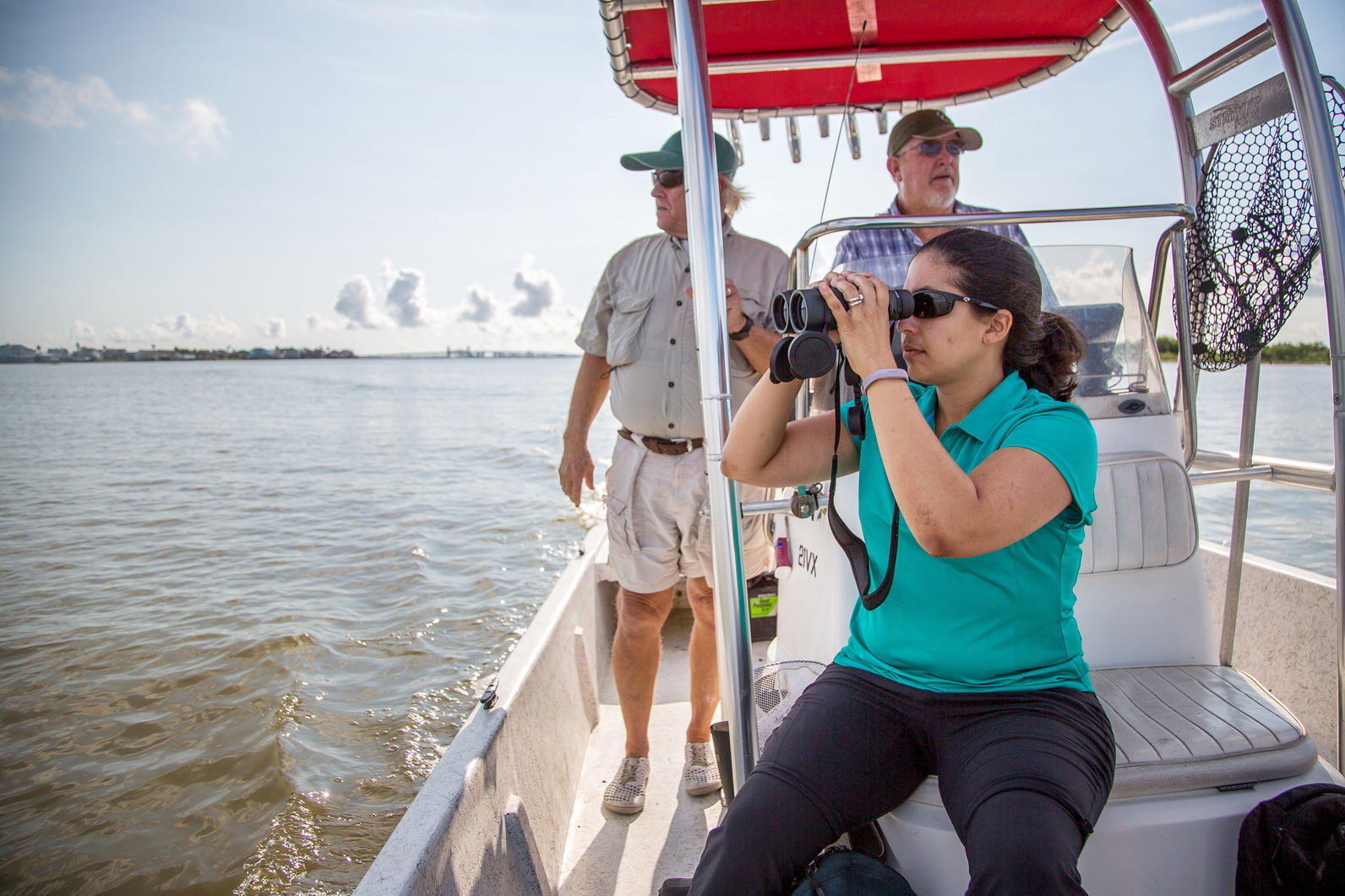
On Tuesday morning, I joined Audubon Texas’s Coastal Conservation program manager, Victoria Vazquez, and coastal warden, Dennis Jones, to visit some of the rookery islands off the coast of Galveston and assess the damage. They wanted to take a look at things like how much land had been lost and how much plant cover was missing due to being uprooted or washed away. Changes like these could affect the number of species that will be able to nest on the habitat in the future.
Audubon Texas and partner organizations like Houston Auduboncollectively own or lease more than 170 coastal islands, some of which appear and disappear as currents shift and waves wash over them. These islands, even when they’re no more than sandbars, are supremely important for many colonial waterbirds—birds that gather in groups—as they nest and breed during the spring and summer months. Visit at the right time and you’ll find American Oystercatchers, Brown Pelicans, Least Terns, and more. (But be careful—birds are especially vulnerable during nesting season and no visitors are allowed on the islands from February through August.) Brown Pelicans in particular were at risk of extinction in the 1970s, and although they’ve made a comeback since then, their nesting areas (and those of many other species) are now in trouble due to rising sea levels and stronger storms caused by climate change. So it was a positive that most of the chicks had fledged by the time Harvey hit.
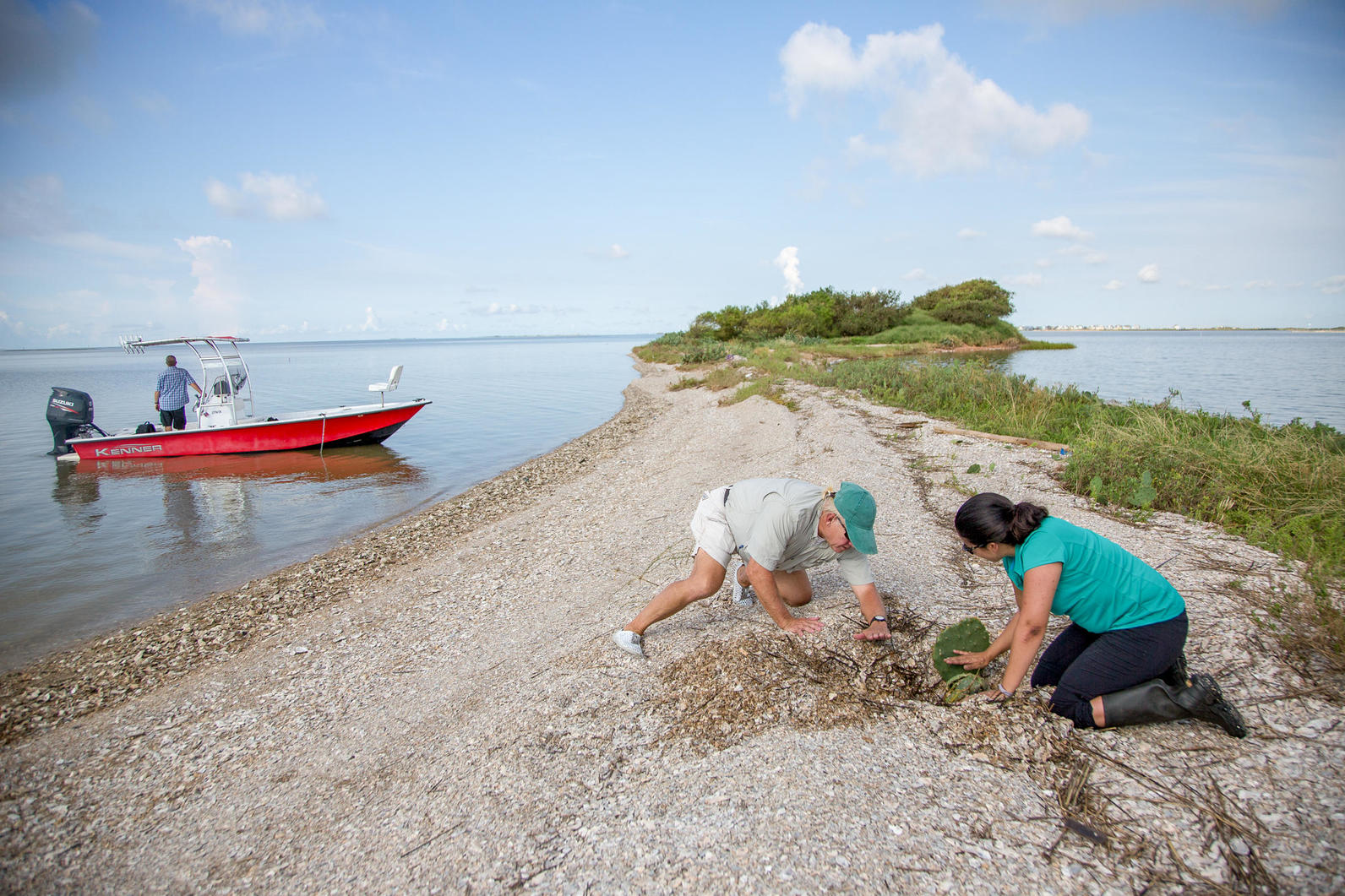
We reached the first island, simply called Mile Marker 52, dropped anchor in about a foot of water, and waded to shore. The first thing Victoria and Dennis did was try to figure out how much of the island had been under water. Mile Marker 52 is a long, low island, with some bushes, shrubs, and other plants on either end. They determined that a thin strip, which is about three or four feet above sea level, was the only portion that had remained above water during the hurricane. In addition, the inundation of water had washed shells and rocks onto the land, far enough to bury some prickly pear cactus, plants often used by birds as takeoff platforms or shelter. Victoria spent some time digging out a number of cacti to figure out how deep they’d been buried, earning some spines for her troubles. And in my enthusiasm to see everything being pointed out to me, I got biting ants all over my water shoes. Thankfully they weren’t fire ants!
On our way to the next island we passed a few different types of breakwaters. These structures protect small islands from erosion caused by a ship’s wake, winds, and strong currents. The water behind some breakwaters moves more slowly, which allows marsh grasses to grow and provides additional feeding habitat for birds.
After our hardy boat captain navigated through some fairly shallow areas, we ended up at North Deer Island, an island that is co-owned by Audubon Texas, Houston Audubon, and other partners. Fun fact about this island: It’s populated by rattlesnakes. We stepped gingerly through the brush, keeping our eyes—and ears—peeled for any stray reptiles. To my relief (and frankly, also to my dismay), we had no encounters on this trip. But Dennis helpfully pointed out that he’d seen a rattlesnake right on the path we were traveling the last time he’d visited the island.
Here again it was clear to see how the waves had washed ashore and brought shells, rocks, and debris along for the ride. Victoria continued her assessment of the damage, noting things like changes to the shoreline, approximate height of the maximum storm surge, extent of erosion on vegetation, and presence of trash on the island. We had only a limited time that morning, so more detailed assessments would have to be conducted later. Aerial imagery will be used to calculate the change in island size and basic habitat types, and recent population data for each island will be used to determine what kind of upkeep needs to be done. For example, does the island need more bare ground, do native plants need to be planted, will new structures need to be installed to protect the island in the future?

Though nesting season was over, recently fledged and adult birds were all over the place: on islands, on sandbars, swimming in the Intracoastal. At one point we passed hundreds of Brown Pelicans sitting on a series of sandbars right near the Galveston Causeway. It was nice to see them up to their normal activities after the storm.
The next day, I went out into the field with Kari Howard, who’s in charge of Audubon Texas’s TERN program. TERN is a community science program that connects volunteers to real conservation work with the Audubon Coastal Conservation staff and partners. We visited several TERN sites where I was able to meet some of the volunteers. These are people who spend their free time doing things like running bird surveys, kayaking out to coastal islands to monitor bird populations, helping restore and maintain rookery islands after nesting season ends, and leading education and outreach efforts, among many other projects. Their involvement and importance cannot be overstated. Though they’ve been through a lot already in the last two weeks, TERN community scientists like Dianne Forthman and Tim Long are ready to begin cleanup and restoration efforts for these important habitats.
My trip out to these locations gave me only an inkling of Hurricane Harvey’s impact. While I was based in the Galveston area, places farther down the coast were hit much harder. Sundown Island Sanctuary, off the coast of Port O’Connor, is an Important Bird Area. The 80-acre island is managed and protected by Audubon Texas as a colonial waterbird nesting island and bird sanctuary. It supports many bird species, including hosting one of the largest colonies of the state-threatened Reddish Egrets on the Texas coast. In addition, it serves as a stopover feeding and resting site for songbirds and hummingbirds during migration.
I spoke with Iliana Peña, Director of Conservation at Audubon Texas, to get a sense of the damage. She told me that approximately four acres of land were lost. Though that number may seem small, Iliana says that the loss of nesting colonial waterbird habitat is always detrimental, especially considering the competition for space between species such as Reddish Egrets, Tricolored Herons, and Brown Pelicans. Habitat takes time and effort to recover. Sundown Island has a history of erosion so habitat restoration projects will be especially important in the aftermath of the storm.
The full impact of Hurricane Harvey on these islands and their birds will not be known until at least next year’s breeding season. Victoria says that if the islands remain as they are now, it’s likely that significantly fewer breeding pairs will be able to nest on them, not to mention the impact on migrating species. However, Audubon, its partners, and volunteer community scientists will spend the next several months working to restore these places—not just for the birds, but also for the coastal communities that depend on them for ecotourism.


