

Groundwater Data Viewer: Got groundwater? Use this tool to explore water well locations and well reports.
If you’re planning on drilling a water well or want to find information about current wells on your property, the Groundwater Data Viewer from the Texas Water Development Board supports water planning with respresentative information about aquifers in Texas! This resource is an interactive map that allows you to view well locations as well as drillers reports on wells in your area. Keep in mind, location data may not be exact.
The data in Water Data Interactive represents the best available information provided by the TWDB and third-party cooperators of the TWDB. The TWDB provides information via this web site as a public service. Neither the State of Texas nor the TWDB assumes any legal liability or responsibility or makes any guarantees or warranties as to the accuracy, completeness, or suitability of the information for any particular purpose. Water Data Interactive is still a great resource when planning to drill a well or if you just need to find those drillers logs from past wells.
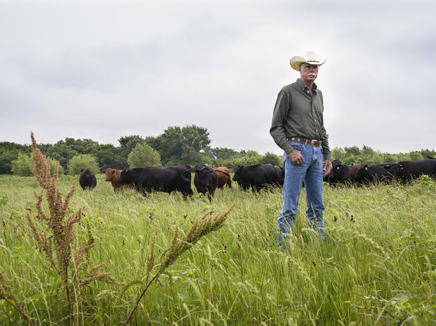
Rangeland Analysis Platform: Wondering how much livestock you can sustain? This platform allows you to view vegetation production and history.
The Rangeland Analysis Platform is a new tool from the USDA’s Agricultural Research Service that provides powerful perspective and context for rangeland monitoring. Use it to develop new management strategies and to evaluate current or past management practices. This platform combines satellite imagery with thousands of on-the-ground vegetation measurements collected by BLM, NPS, and NRCS to give you insight into the vegetation productivity of your land.
Here you can view current and historical above ground biomass production, and even see above ground cover specified by perennial forb and grass, annual forb and grass, shrubs, trees, and even bare ground.
Seed Spec: Thinking of prairie restoration or reclamation? This tool will show you the best plant species and varieties for your seed mix.
Whether it’s for range improvement or reclamation, re-seeding can be a daunting task. However, SeedSpec is a new tool that can make designing your own seed mix easier than ever. Simply sign up, draw the boundaries of your project, and SeedSpec will put together seed mix suggestions. Each mix is specifically tailored by species and variety to the soils and ecological types within your project area.
Texas Railroad Commission GIS viewer: Oil and gas activity on your property? View pipelines, orphan wells, disposal sites and more with the RRC GIS Viewer.
As much as we like to learn about the natural resources on our property, it is also important to understand the man-made resources. In Texas especially, it’s helpful to have an idea of past and present energy production activity.
Thankfully, the location of many abandoned wells, injection sites, pipelines, and much more are accessible to the public. The Texas Railroad Commission has developed a public GIS viewer, which is an interactive map that allows us to view spatial data on these utilities. This data is for informational purposes only.
They are not intended to be used as an authoritative public record for any geographic location and have no legal force or effect. Organizations and individual users are responsible for verifying the accuracy, completeness, currency, and/or suitability of these data sets themselves. Always call 811 before beginning any ground disturbing activity.
Web Soil Survey: What does your soil mean for your operation? Web Soil Survey can help you understand what's under your feet and how it affects your bottom line.
Web Soil Survey (WSS) is a free online resource to explore your lands soil types. Operated by the USDA Natural Resources Conservation Service (NRCS). WSS provides soil data and information produced by the National Cooperative Soil Survey.
It provides access to the largest natural resource information system in the world. Not only does WSS provide soil data, but you can also explore your ecological sites, estimated range production, and much more. WSS can be used to make maps with your land’s data, and will break down the information into handy reports, as well.
LANDSS Tool from Borderland Research Institute
Land and Nature Decision Support System (LANDSS): Energy production is a lucrative aspect of many ranching operations in the TransPecos. This platform allows landowners and developers to view how potential site selections may impact other aspects of their property. Many questions arise when considering energy development on your property. However, Borderlands Research Institute has developed a geographic tool based on their latest research to help you determine what areas of your property would have the least impact on wildlife, water, tourism, community, and culture should they be developed for energy production. LANDSS focuses on 18 counties in far west Texas, and while it is not a substitute for on the ground knowledge, it can be a helpful first step in understanding potential impacts from oil and gas or renewable energy development. Click here to learn more and access the LANDSS tool.
How you can help, right now
Join Audubon Texas Today
Becoming a member supports our local work protecting birds and the places they need.

Consider a Legacy Gift for Texas
Planned gifts and bequests allow you to provide a lasting form of support to Audubon Texas.

Subscribe to Our Newsletter
Subscribe to our newsletter for updates about Audubon Texas's conservation work, and news about our activities and local events.
